The House of Representatives is preparing to launch an online transparency platform that will allow the public to track government projects associated with lawmakers, as congressional leaders push for stricter verification of project documentation and geographic coordinates in the proposed 2027 national budget.
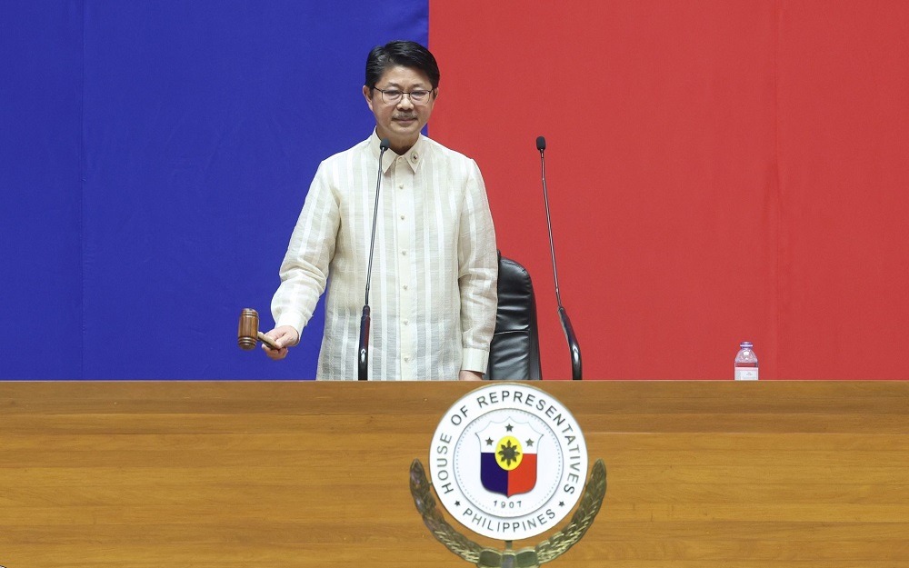
House speaker Faustino “Bojie” Dy III announced on Monday, Nov. 9, that the platform would provide public access to project names, locations, funding allocations, and completion status, allowing citizens to examine how government resources are distributed and implemented.
Dy said development of the platform began in September and that it would be accessible to the public in the coming days.
“We want our people to have access to accurate information and this transparency platform delivers a loud and clear message: Wala pong tinatago ang Kapulungan ng mga Kinatawan,” Dy said during the resumption of House plenary sessions.
The initiative is part of the House leadership’s efforts to make budget information more accessible and subject government spending to greater public scrutiny.
The planned platform comes as lawmakers face questions about the accuracy and completeness of information submitted for infrastructure projects included in the proposed 2027 national budget.
At a separate press briefing, House leaders said projects with missing documentation, absent geotags, or incorrect geographic coordinates should be removed during bicameral conference committee deliberations.
“Pag kulang, tanggal,” House Appropriations vice chairperson and Camarines Sur 4th District rep. Arnie Fuentebella said.
FPJ Panday Bayanihan Party-list Rep. Brian Poe said the same standard should apply to projects whose locations cannot be properly verified.
“No papers, no geo-tag or maling geo-tag, pagdating sa bicam, tanggal,” Poe said.
“We will not accept projects that have no proper papers, proper coordinates because that is unfair to the constituents, and that is also unfair to the representatives who have been working so hard to make sure that the people get the right kind of projects, especially in this budget.”
Geotagging associates geographic coordinates with a project or location, allowing its reported site to be checked against maps and other geographic information. Accurate location data can help identify discrepancies in project records and support monitoring of infrastructure implementation.
The lawmakers were responding to questions about reported documentation concerns involving 355 infrastructure projects worth approximately P6 billion.
House Committee on Appropriations senior vice chairperson and Bataan 2nd District rep. Albert Raymond Garcia asked critics to identify the specific project entries so lawmakers could verify them with the implementing agencies.
Garcia cited a farm-to-market road project whose recorded coordinates incorrectly placed it at sea. He said the Department of Agriculture confirmed that the discrepancy resulted from a typographical error.
The incident highlighted the importance of verifying digital location records before relying on them to assess government projects.
Fuentebella also encouraged civil society organizations to identify specific discrepancies while the proposed spending measure remains under review.
Alongside the proposed online database and tighter geotagging requirements, the House plans to continue livestreaming budget deliberations to give the public greater visibility into congressional decisions.
Dy said bicameral conference committee proceedings on the 2027 national budget would again be broadcast online, allowing citizens to follow discussions and amendments to the spending measure.