A locally-developed app has been unveiled to monitor the environment, particularly bodies of water such as Manila Bay.
The app called Masdan, is part of efforts by the Department of Science and Technology (DOST) to use technology to rehabilitate and sustain the Manila Bay area. The umbrella project, dubbed “IM4ManilaBay” calls on citizen science to augment government efforts.

The IM4ManilaBay program is composed of four projects, one of which is Project MapABLE or the Development of an Integrated Mapping, Monitoring, and Analytical Network System for Manila Bay and Linked Environments (MApABLE).
The Masdan app is part of Project MapABLE and is envisioned as a platform for citizen science to map and monitor the water quality in Manila Bay.
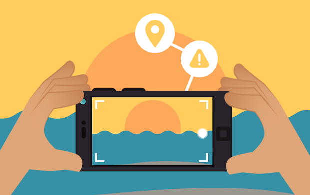
The Masdan app allows citizens to send information and evidence such as photos and then sending this information to a network linked to the DOST.
The information can then be verified and analyzed by teams from the DOST and the Department of Environment and Natural Resources.
Masdan is expected to be used for Manila Bay and Laguna Lake and river tributaries nearby but is expected to be rolled out nationwide, particularly on important watersheds and other key bodies of water across the archipelago.
Dr. Ariel C. Blanco, project and team leader for Masdan under Project MapABLE, noted that Masdan is linked to an “analytical network system.”
Blanco said government researchers believe that “everything is mappable” but the challenge is “choosing what is important to be mapped, hence the name “MapABLE”
He emphasized that Masdan will rely on “citizen science” where “everyone has a role to play towards generating information, working with LGUs around Manila Bay, other NGOs, nonprofit organizations, etc.”
“Masdan is just one of the ways of enabling the mapping of the environment, relying on geospatial technologies, but capitalizes on the role of citizen science,” he said.
Citizens can report their findings by capturing images of garbage, the color of the water, informal settlers along the banks, etc.
Citizens can further join researchers in reporting algal bloom, fish kill, water hyacinth, pollution, reclamation, solid wastes, etc.
Researchers said Masdan follows a “crowdsourcing” model in gathering information. Verifying these reports will be the responsibility of government agencies and task forces from the DENR, for example, although the Coast Guard and local government teams can participate.
In the future, even the private sector can use the app particularly in conducting corporate responsibility programs, for instance.
The whole Project MapABLE is funded through a P10-million grant from the DOST.
Currently, the project team for Masdan is awaiting a Google evaluation because the Android-powered app will be made available on Google Store. A version for iOS is still in development.


