The Philippine Space Agency (PhilSA) has begun analyzing satellite imagery to identify areas potentially affected by the magnitude 7.8 earthquake that struck Mindanao on June 8, using changes in nighttime light patterns as an indicator of damage and disruption.
In a preliminary assessment released on June 11, PhilSA compared nighttime satellite images taken before and after the earthquake and found several areas showing reduced illumination, which may indicate power outages, infrastructure damage, or population displacement.
Among the locations that showed a decrease in nighttime light were the General Santos City barangays of Labangal, Apopong, San Isidro, City Heights, and the coastal barangays of Siguel and Tambler.
Similar reductions were observed in the Sarangani municipalities of Maasim and Glan, as well as in Polomolok, South Cotabato.
PhilSA said the analysis compared satellite imagery captured at 1:30 a.m. on June 8 and 1:12 a.m. on June 9.
According to the agency, changes in nighttime illumination can serve as a rapid assessment tool following disasters.
“When lights go out, it often signals power loss, infrastructure damage, or population displacement/evacuation,” PhilSA said.
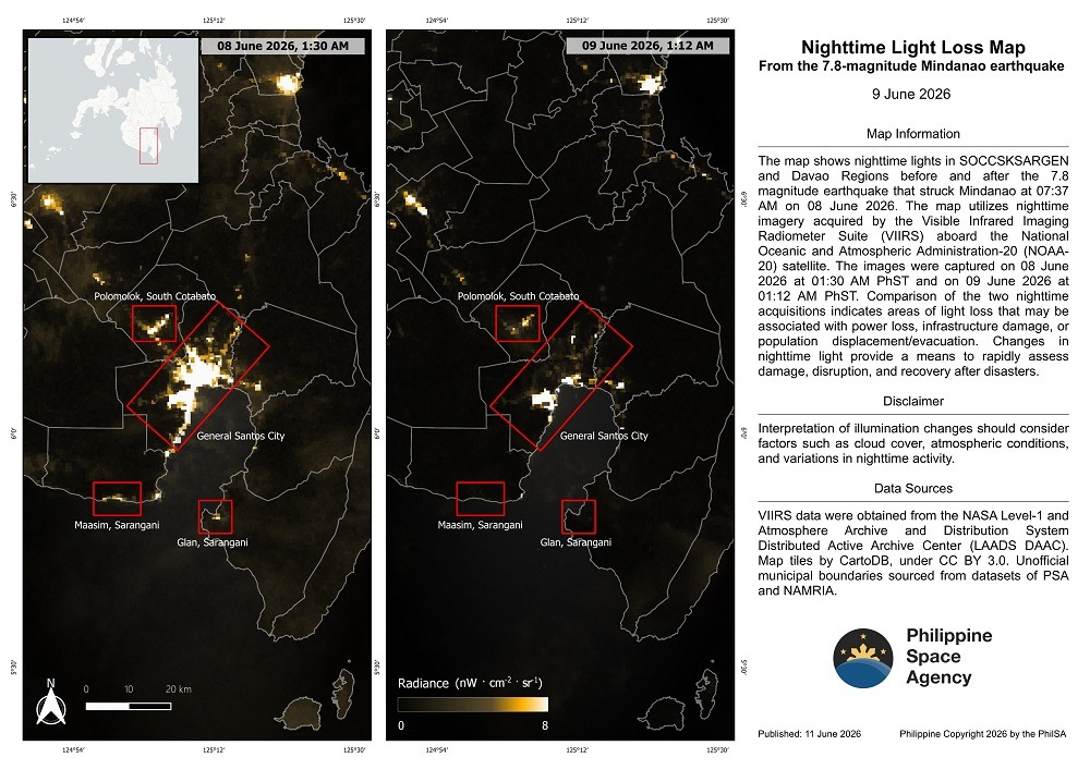
The agency stressed that the findings remain preliminary and are based on visual comparisons of satellite data. It said further analysis is underway to refine the identification of affected areas and improve damage assessments.
PhilSA added that the return of nighttime lighting in affected communities could also be used to track reconstruction and recovery efforts in the coming weeks and months.
The agency said its satellite-based monitoring provides wide-area coverage that can help the National Disaster Risk Reduction and Management Council prioritize response efforts and support decision-making during emergencies.
PhilSA said it will continue monitoring satellite data as the situation develops.